Introduction
Unmanned Aerial Vehicle (UAV) fleet management platforms represent the critical command-and-control infrastructure required to operate drone programs at scale. As organizations move beyond single-pilot operations toward complex, multi-site deployments, the need for a centralized digital nervous system becomes paramount. These platforms integrate flight planning, real-time telemetry, regulatory compliance, and automated data processing into a single pane of glass. For modern enterprises in agriculture, construction, and public safety, this technology is the primary driver of operational safety and mission reliability. By digitizing the entire drone lifecycle, from pre-flight checklists to post-mission analysis, these systems ensure that aerial operations are both efficient and legally defensible.
In the current global landscape, the shift toward “Drone-in-a-Box” solutions and beyond visual line of sight (BVLOS) operations has made robust management software a non-negotiable requirement. Manual logbooks and fragmented spreadsheets are no longer sufficient for managing the technical health of expensive hardware or the certification currency of multiple pilots. A professional fleet management platform enables automated airspace authorization, precise hardware maintenance tracking, and sophisticated data security protocols that protect sensitive aerial imagery. When evaluating these systems, organizations must assess the depth of their live streaming capabilities, the seamlessness of their integration with GIS software, and the scalability of their cloud infrastructure to support thousands of annual flight hours.
Best for: Enterprise drone programs, public safety agencies, industrial inspection firms, and large-scale agricultural operations that require a unified system for flight operations and compliance management.
Not ideal for: Recreational hobbyists flying a single aircraft for personal use, or small photography businesses that do not need to track multiple assets, pilots, or complex regulatory requirements.
Key Trends in UAV Fleet Management Platforms
The integration of Artificial Intelligence (AI) has moved into the core of fleet management, with systems now offering automated “detect and avoid” warnings and predictive maintenance alerts based on real-time motor and battery telemetry. We are also seeing a significant move toward “hardware-agnostic” architectures that allow organizations to manage a mixed fleet of drones from different manufacturers within a single interface. Real-time 5G connectivity is replacing traditional radio links for data transmission, allowing for low-latency live streaming of high-definition thermal and optical feeds to command centers anywhere in the world.
Remote ID compliance is another dominant trend, with platforms now serving as the primary digital broadcast point to satisfy global aviation authority requirements. There is a heightened focus on data sovereignty, as organizations adopt secure edge computing models to process sensitive infrastructure data locally before syncing to the cloud. Furthermore, the shift toward fully autonomous workflows allows for scheduled missions where drones self-deploy from docking stations, perform inspections, and upload data without human intervention. The rise of “Spatial Digital Twins” is also driving deeper integration between flight logs and 3D environment models for enhanced situational awareness.
How We Selected These Tools
Our selection process involved a rigorous assessment of operational reliability and functional depth within the commercial drone sector. We prioritized platforms that have demonstrated high uptime and have been adopted by major industrial players and government agencies. A key criterion was “interoperability,” evaluating how well each platform communicates with various drone brands and essential third-party software such as ESRI or Autodesk. We looked for a balance between sophisticated mission planning capabilities and an intuitive interface that can be utilized by field operators under high-stress conditions.
Scalability was a major factor; we selected tools that can support the growth of a drone program from five aircraft to five hundred. Security certifications were scrutinized to ensure alignment with international standards such as SOC 2 and GDPR, which are critical for protecting proprietary industrial data. Finally, we assessed the quality of the automated compliance engines, specifically their ability to integrate with local airspace authorities for real-time flight authorizations. The resulting list provides a comprehensive range of options for different operational scales and industry-specific needs.
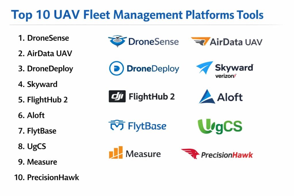
1. DroneSense
DroneSense is an enterprise-grade platform specifically tailored for public safety and emergency response teams. It provides a comprehensive ecosystem that includes flight control, live streaming, and complete fleet management. Its focus on situational awareness makes it the standard for police, fire, and search and rescue agencies.
Key Features
The platform features a “Magic Window” that allows incident commanders to view live video feeds from multiple drones simultaneously. It includes a robust pilot application that works across various hardware brands to provide a consistent flying experience. The “AirBase” module automatically logs every flight second, battery cycle, and pilot hour for effortless compliance. Advanced mission planning tools allow for the creation of complex search patterns that can be shared instantly with field teams. It also features a secure, encrypted evidence management system for sensitive aerial data.
Pros
The platform is built by public safety professionals, resulting in highly specialized workflows for emergency scenarios. Its live streaming latency is among the lowest in the industry.
Cons
The pricing is geared toward governmental and large enterprise budgets. Its focus on public safety may mean fewer features for specialized agricultural or construction use cases.
Platforms and Deployment
Web-based management console with mobile applications for iOS and Android. Cloud-native deployment.
Security and Compliance
Adheres to strict government security standards, including CJIS-ready data centers and SOC 2 compliance.
Integrations and Ecosystem
Integrates with major public safety software and offers deep hardware support for DJI, Autel, and Parrot aircraft.
Support and Community
Provides dedicated 24/7 support for emergency agencies and a specialized training academy for public safety pilots.
2. AirData UAV
AirData UAV is a data-centric fleet management platform that focuses heavily on flight logging and hardware health analytics. It is designed for organizations that prioritize deep technical insights and meticulous maintenance tracking to ensure fleet longevity.
Key Features
The standout feature is its “Automatic Flight Upload,” which syncs flight logs from various pilot apps without manual intervention. It includes an “Advanced Power Analysis” tool that tracks individual battery cell health over hundreds of cycles to prevent in-flight failures. The platform features an automated maintenance scheduler that alerts teams based on flight hours or calendar days. It offers “Airspace Intelligence” for pre-flight safety checks and weather monitoring. Its reporting engine generates detailed compliance documents for civil aviation authorities with a single click.
Pros
It offers the most detailed hardware health analytics on the market. The platform is highly compatible with nearly every major drone manufacturer and pilot application.
Cons
The user interface is information-dense and can feel less modern than some newer competitors. It lacks some of the advanced real-time live-streaming features found in mission-centric tools.
Platforms and Deployment
Web-based SaaS with a mobile app for field data syncing.
Security and Compliance
Features data encryption and allows for private cloud or on-premise deployments for enterprise users.
Integrations and Ecosystem
Offers native integrations with DJI, Autel, and various third-party flight apps like DroneDeploy and Pix4D.
Support and Community
Known for excellent technical support and a massive database of community-contributed hardware performance data.
3. DroneDeploy
DroneDeploy is a versatile, all-in-one platform known for its industry-leading photogrammetry and mapping capabilities. It has evolved into a complete fleet management solution that bridges the gap between flight operations and high-end data analysis.
Key Features
The platform features “Standup Flight,” an automated mission planning tool for high-accuracy 3D mapping and site inspections. It includes a “Fleet Management” dashboard that tracks pilot currency and aircraft status across global teams. The “Live Map” feature allows users to see a low-resolution map being generated in real-time as the drone flies. It offers advanced “Radiometric Thermal” analysis for industrial inspections. The system also features a robust “App Market” where users can add specialized tools for agriculture or construction.
Pros
It provides the most seamless transition from flying a mission to generating a professional 3D map. The interface is exceptionally user-friendly for non-technical staff.
Cons
The cost can increase significantly as you add more aircraft and advanced processing features. Some enterprise users find the “all-in-one” approach less flexible for custom workflows.
Platforms and Deployment
Web-based SaaS with mobile flight apps for iOS and Android.
Security and Compliance
Maintains high standards including SOC 2 Type II and GDPR compliance, with secure data hosting options.
Integrations and Ecosystem
Boasts the largest app ecosystem in the drone industry, with deep links to Autodesk, Procore, and Bluebeam.
Support and Community
Provides a comprehensive online university and a vibrant community forum for professional drone operators.
4. Skyward (A Verizon Company)
Skyward is a comprehensive drone operations platform that leverages Verizon’s cellular network expertise. It is designed for large-scale enterprise programs that require high-level oversight of pilots, equipment, and regulatory compliance.
Key Features
The platform features “In-Flight Data Connectivity,” allowing for the use of cellular links for command and control. It includes a “Program Management” suite that handles everything from pilot training records to insurance documents. The “Airspace Map” provides real-time LAANC authorizations directly from the FAA. It offers advanced “Live Streaming” capabilities that utilize the Verizon 5G network for ultra-high-definition feeds. The system also features a “Logbook” that automatically captures flight telemetry for every mission.
Pros
The backing of a major telecommunications company ensures excellent stability and network integration. It is specifically built for the regulatory needs of the US market.
Cons
The platform is primarily focused on the US, making it less ideal for global teams. It is a premium product with a price point aimed at major corporations.
Platforms and Deployment
Web-based SaaS with mobile applications.
Security and Compliance
Features enterprise-grade security including SSO and is fully compliant with FAA Part 107 tracking requirements.
Integrations and Ecosystem
Strong integrations with major hardware providers and various enterprise resource planning (ERP) systems.
Support and Community
Offers professional consulting services to help large companies stand up their drone programs from scratch.
5. DJI FlightHub 2
DJI FlightHub 2 is a cloud-based mission management platform designed specifically for DJI’s enterprise hardware. It offers deep, native integration that provides unparalleled control over the most widely used drones in the world.
Key Features
The platform features a “2.5D Base Map” that provides enhanced situational awareness in mountainous or urban terrain. It includes “Live Annotations,” allowing teams to draw on a shared map in real-time to coordinate ground movements. The system features automated “Media Sync,” where photos and videos are uploaded to the cloud as they are captured. It offers a specialized interface for managing “DJI Dock” autonomous charging stations. It also provides a centralized dashboard for tracking the firmware and battery health of the entire DJI fleet.
Pros
As a first-party tool, it offers the most stable and feature-rich connection to DJI hardware. The real-time collaboration features are exceptionally smooth.
Cons
It is limited exclusively to DJI hardware, which may be a dealbreaker for teams with a mixed fleet. Some users have concerns regarding data residency and international regulations.
Platforms and Deployment
Web-based browser interface.
Security and Compliance
Offers a “Private Cloud” deployment option to ensure that all data remains within a local network or specific geographic region.
Integrations and Ecosystem
Natively integrated with the DJI Pilot 2 app and all DJI enterprise-level aircraft.
Support and Community
Supported by DJI’s global network of enterprise dealers and a massive professional user base.
6. Aloft (Formerly Kittyhawk)
Aloft is a leading provider of drone fleet management and airspace intelligence, serving as a primary partner for the FAA’s LAANC program. It is designed for teams that prioritize regulatory compliance and automated flight authorization.
Key Features
The platform features the “Aloft Airspace” app, which is the most widely used tool for obtaining real-time flight authorizations. It includes a “Fleet Management” module that tracks pilot certifications and hardware maintenance schedules. The “Dynamic Airspace” feature provides real-time alerts for temporary flight restrictions and nearby aircraft. It offers an “Automated Logbook” that syncs telemetry from various hardware types. The system also features “Checklists” that ensure every pilot follows standard operating procedures before take-off.
Pros
It is the gold standard for airspace authorization and regulatory compliance. The platform is highly accessible and offers a free tier for small operations.
Cons
The fleet management features are not as deep as specialized analytical tools like AirData. Its interface is highly focused on compliance rather than data processing.
Platforms and Deployment
Web-based SaaS and mobile apps for iOS and Android.
Security and Compliance
SOC 2 Type II compliant and a certified partner for governmental airspace authorization programs.
Integrations and Ecosystem
Integrates with DJI hardware and various enterprise project management tools.
Support and Community
Provides extensive documentation and is a major voice in the drone regulatory community.
7. FlytBase
FlytBase is an enterprise-grade platform specialized in “Drone-in-a-Box” operations and fully autonomous fleet management. It is designed for industries like security and mining that require remote, scheduled drone missions.
Key Features
The platform features “Remote Command & Control,” allowing a pilot in a centralized office to fly a drone located hundreds of miles away. It includes a specialized “Docking Station Management” module for automated charging and deployment. The system offers “Precision Landing” technology to ensure drones return safely to their docks. It features “Live Video Streaming” with multi-user access for remote monitoring. It also provides an open API for developers to build custom autonomous workflows.
Pros
It is one of the most advanced tools for fully autonomous, remote drone operations. Its hardware-agnostic approach allows it to work with various docking station manufacturers.
Cons
The setup is technically intensive and requires significant hardware investment. It is not designed for simple, manual photography missions.
Platforms and Deployment
Web-based SaaS with private cloud and on-premise options.
Security and Compliance
Offers end-to-end encryption for all command and control links and is GDPR compliant.
Integrations and Ecosystem
Supports a wide range of hardware and provides a robust SDK for enterprise software integration.
Support and Community
Offers dedicated technical support for complex autonomous deployments and specialized partner training.
8. UgCS (Universal Ground Control Software)
UgCS is a professional mission planning and fleet management software known for its power in complex industrial and geophysical surveys. It offers unparalleled control over flight parameters and specialized sensor payloads.
Key Features
The software features “True Terrain Following,” allowing drones to fly at a constant height above the ground using high-resolution elevation data. It includes a “Multi-Node” architecture that allows multiple pilots to be managed from a central server. The system offers specialized “Geophysical Search” patterns for magnetometers and ground-penetrating radar. It features a “Route Import” tool that accepts KML and CSV files for precise flight paths. It also provides an “Offline Mode” for operations in remote areas without internet.
Pros
It provides the most granular control over flight paths and sensor triggers in the industry. The offline capability is essential for remote industrial sites.
Cons
The user interface has a significant learning curve and is designed for technical experts. It is a local-first software that requires more manual setup for cloud syncing.
Platforms and Deployment
Windows, macOS, and Linux local installation with optional central server sync.
Security and Compliance
Allows for completely air-gapped operations, providing the highest level of data security for sensitive missions.
Integrations and Ecosystem
Supports a vast range of hardware, from DJI to custom Pixhawk-based aircraft and specialized LIDAR sensors.
Support and Community
Provides deep technical documentation and is supported by a community of specialized industrial drone operators.
9. Measure Ground Control
Measure Ground Control is a comprehensive, cloud-based platform that combines mission planning, flight tracking, and data processing. It is designed to provide a professional, end-to-end workflow for enterprise drone teams.
Key Features
The platform features an “Integrated Flight App” that supports automated and manual flying for various hardware types. It includes a “Program Management” dashboard that monitors pilot activity and hardware health in real-time. The system offers “Automated Data Processing” for creating high-quality maps and 3D models. It features a “Safety and Compliance” module with built-in checklists and incident reporting. It also provides a “Live Streaming” tool for real-time remote oversight.
Pros
It provides a very cohesive workflow where flight data and processed maps live in the same place. The pricing is competitive for the breadth of features offered.
Cons
Some users find the data processing times to be slower than specialized mapping tools. The mobile app can occasionally experience stability issues with certain hardware.
Platforms and Deployment
Web-based SaaS and mobile apps for iOS and Android.
Security and Compliance
Maintains SOC 2 Type II compliance and focuses on secure data handling for enterprise clients.
Integrations and Ecosystem
Integrates with popular GIS and CAD tools, providing a bridge between aerial data and engineering workflows.
Support and Community
Offers a dedicated customer success team and a wealth of educational resources for drone program managers.
10. PrecisionHawk PrecisionAnalytics
PrecisionHawk is a pioneer in the drone industry, offering a platform that focuses on AI-driven data analysis for large-scale infrastructure and agricultural fleets. It is built for organizations that need to turn thousands of images into actionable insights.
Key Features
The platform features “AI Inventory,” which automatically identifies and counts assets like solar panels or agricultural crops. It includes a “Change Detection” tool that highlights differences between different flight dates on a construction site. The system offers specialized “Energy Inspection” modules for power lines and wind turbines. It features a “Fleet Dashboard” for managing distributed teams of pilots. It also provides “Advanced Reporting” that summarizes technical findings into executive-ready documents.
Pros
The AI-driven analysis saves thousands of hours in manual data review. The platform is built with a deep understanding of specific industrial requirements.
Cons
It is a premium, high-end tool that may be over-engineered for basic drone operations. The interface is focused more on the data result than the flying experience.
Platforms and Deployment
Web-based SaaS.
Security and Compliance
Adheres to rigorous enterprise standards and provides secure, tiered access for large global teams.
Integrations and Ecosystem
Strong integrations with agricultural and energy management software systems.
Support and Community
Provides high-touch professional services and specialized training for industrial drone applications.
Comparison Table
| Tool Name | Best For | Platform(s) Supported | Deployment | Standout Feature | Public Rating |
| 1. DroneSense | Public Safety | Web, iOS, Android | Cloud-Native | Live Multi-Stream | 4.9/5 |
| 2. AirData UAV | Fleet Analytics | Web, Mobile Sync | Hybrid | Battery Health Detail | 4.8/5 |
| 3. DroneDeploy | Photogrammetry | Web, iOS, Android | Cloud SaaS | 3D Mapping Engine | 4.7/5 |
| 4. Skyward | Corporate Oversight | Web, iOS, Android | Cloud SaaS | 5G Live Streaming | 4.3/5 |
| 5. DJI FlightHub 2 | DJI Fleets | Web-Based | Cloud/Private | Native 2.5D Mapping | 4.6/5 |
| 6. Aloft | Compliance | Web, iOS, Android | Cloud SaaS | LAANC Authorization | 4.8/5 |
| 7. FlytBase | Autonomous Docks | Web-Based | Hybrid/On-Prem | Remote Command | 4.5/5 |
| 8. UgCS | Technical Surveys | Win, Mac, Linux | Local / Server | Terrain Following | 4.7/5 |
| 9. Measure | End-to-End Ops | Web, iOS, Android | Cloud SaaS | Flight-to-Map Flow | 4.4/5 |
| 10. PrecisionHawk | AI Data Analysis | Web-Based | Cloud SaaS | Automated Asset ID | 4.2/5 |
Evaluation & Scoring of UAV Fleet Management Platforms
The scoring below is a comparative model intended to help shortlisting. Each criterion is scored from 1–10, then a weighted total from 0–10 is calculated using the weights listed. These are analyst estimates based on typical fit and common workflow requirements, not public ratings.
Weights:
- Core features – 25%
- Ease of use – 15%
- Integrations & ecosystem – 15%
- Security & compliance – 10%
- Performance & reliability – 10%
- Support & community – 10%
- Price / value – 15%
| Tool Name | Core (25%) | Ease (15%) | Integrations (15%) | Security (10%) | Performance (10%) | Support (10%) | Value (15%) | Weighted Total |
| 1. DroneSense | 10 | 8 | 9 | 10 | 9 | 10 | 7 | 9.00 |
| 2. AirData UAV | 8 | 7 | 9 | 8 | 10 | 9 | 9 | 8.45 |
| 3. DroneDeploy | 9 | 10 | 10 | 9 | 9 | 9 | 7 | 8.95 |
| 4. Skyward | 8 | 8 | 8 | 9 | 9 | 8 | 6 | 7.75 |
| 5. FlightHub 2 | 9 | 9 | 6 | 8 | 9 | 8 | 9 | 8.15 |
| 6. Aloft | 7 | 10 | 8 | 9 | 8 | 9 | 10 | 8.35 |
| 7. FlytBase | 9 | 6 | 9 | 9 | 10 | 8 | 7 | 8.25 |
| 8. UgCS | 10 | 3 | 9 | 10 | 10 | 8 | 8 | 8.00 |
| 9. Measure | 8 | 8 | 8 | 8 | 8 | 8 | 8 | 8.00 |
| 10. PrecisionHawk | 9 | 6 | 8 | 9 | 8 | 8 | 6 | 7.75 |
How to interpret the scores:
- Use the weighted total to shortlist candidates, then validate with a pilot.
- A lower score can mean specialization, not weakness.
- Security and compliance scores reflect controllability and governance fit, because certifications are often not publicly stated.
- Actual outcomes vary with assembly size, team skills, templates, and process maturity.
Which UAV Fleet Management Platform Tool Is Right for You?
Solo / Freelancer
For independent pilots or small startup teams, the primary goal is minimizing regulatory friction and keeping simple, accurate logs. You need a platform that offers a high-quality free or low-cost tier with built-in airspace authorization. A mobile-first tool that automatically logs your flights and helps you manage a small set of batteries is the most efficient choice for this stage.
SMB
Organizations using drones for conservation or community monitoring should prioritize ease of use and cost-effective mapping. You need a system that doesn’t require a dedicated IT staff to maintain and can work in remote areas with limited connectivity. A tool that provides a clear “flight-to-data” workflow will help your small team focus on the mission rather than the technical administration.
Mid-Market
Growing commercial drone shops need to start thinking about pilot currency and equipment longevity. At this level, the ability to track battery cycles and hardware maintenance becomes critical for protecting your investment. You should look for a platform that offers automated data syncing and standard operating procedure checklists to ensure a consistent safety culture as you hire more pilots.
Enterprise
For global corporations and industrial giants, the decision is driven by data security, cloud scalability, and deep software integration. You require a system that acts as an enterprise resource planning tool for your aerial assets, providing the security certifications and centralized oversight needed to manage hundreds of simultaneous missions across different continents.
Budget vs Premium
If budget is the primary concern, there are excellent specialized tools for airspace and basic logging that cost very little. However, premium platforms justify their price by providing high-end features like AI-driven data analysis, low-latency live streaming, and dedicated project management that can significantly reduce the “cost per insight” for large organizations.
Feature Depth vs Ease of Use
Highly technical survey tools offer incredible precision but require expert knowledge to operate safely. Conversely, more automated, user-friendly platforms allow a broader range of staff members to contribute to the drone program, though they may have limits on how much you can customize the flight parameters or the data output.
Integrations & Scalability
Your drone software must be able to push data into your existing GIS or engineering platforms. As you grow, the ability to add new hardware types—from different manufacturers—into your management system without a total platform migration is a vital consideration for the long-term technical health of your program.
Security & Compliance Needs
In industries like energy, defense, or government, the security of the flight control link and the aerial imagery is a legal requirement. You must select a platform that offers private cloud or on-premise deployment options and adheres to the specific data residency laws of the regions where you operate.
Frequently Asked Questions (FAQs)
1. What is the difference between fleet management and flight control software?
Flight control software is the app used to actually pilot the drone in real-time. Fleet management software is the overarching dashboard used to track all drones, all pilots, and all flight data across an entire organization over a long period.
2. Why is hardware-agnostic software important?
Hardware-agnostic platforms allow you to manage drones from different manufacturers (like DJI, Autel, and Parrot) in one place. This prevents you from being locked into a single vendor and allows you to use the best drone for each specific task.
3. What is LAANC and why should my platform have it?
LAANC is the Low Altitude Authorization and Notification Capability used by the FAA to provide real-time flight permission in controlled airspace. Having this integrated into your platform allows your pilots to get legal authorization in seconds.
4. How does drone software track battery health?
Most professional platforms read the telemetry data from the drone’s smart batteries, tracking the number of charges, the temperature during flight, and the voltage balance of individual cells to predict when a battery might fail.
5. Can I manage autonomous “Drone-in-a-Box” systems with these tools?
Yes, several advanced platforms are specifically designed to manage docking stations, allowing for remote, scheduled deployments where the drone takes off, flies, and lands back in its charger without a human on-site.
6. Does the software store all my photos and videos?
Most platforms provide cloud storage for mission-related media, though some focus strictly on the telemetry logs. High-end tools also include data processing engines that turn those photos into 3D maps or specialized inspection reports.
7. Is an internet connection required while flying?
While many platforms use the cloud for syncing, professional flight apps often have “offline modes” that allow you to plan and fly missions in remote areas, with the data syncing once you return to an area with connectivity.
8. What are “soft credits” in UAV operations?
In the context of complex missions, soft credits may refer to the recognition of observers or team members who assisted in the safety of a flight without being the pilot in command, ensuring their experience is also documented in the program’s history.
9. How do these platforms handle data security?
Professional platforms use end-to-end encryption for flight data and command links. Many offer the ability to host data on specific regional servers (like AWS GovCloud) to meet strict governmental data sovereignty laws.
10. Do I need a special license to use fleet management software?
While anyone can use the software, operating a drone for commercial purposes usually requires a specific pilot license (like Part 107 in the US). The software helps you track and store these licenses to ensure your program remains legal.
Conclusion
In the modern industrial landscape, a UAV fleet management platform is the digital foundation upon which a safe and scalable drone program is built. These systems have matured from simple logging utilities into comprehensive intelligence hubs that bridge the gap between aerial hardware and actionable business data. By centralizing flight operations, maintenance, and compliance, organizations can move away from reactive troubleshooting and toward a proactive, data-driven strategy. The ideal platform is one that not only secures your current assets but also provide the scalable infrastructure and real-time oversight needed to navigate the complexities of future autonomous flight.